Long Distance Trails – Columbia Trail


NEW YORK/PHILADELPHIA METROPOLITAN AREA
OPEN SPACE RESOURCE LIBRARY
Columbia Trail
Managed by: Hunterdon, Morris Counties
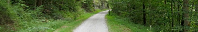
Formerly the High Bridge Branch of the Central Railroad of New Jersey. This trail runs from Bartley Road near Flanders in Morris County to High Bridge in Hunterdon County. It follows closely the South Branch of the Raritan River and passes through the towns of Bartley, Four Bridges, Long Valley, Middle Valley, Crestmoore, Vernoy, Califon, Readingsburg, and High Bridge. The trail has an improved crushed stone surface, and bridges have been decked. The rail bed passes through mixed hardwood forests, pastoral settings, quaint villages, and the scenic Ken Lockwood Gorge. The width of the trail is quite wide compared to other rail trails, and the crushed stone surface can be tough on the feet for those going long distance. The Highlands Trail, Patriot's Path, Gillette Trail, Liberty-Water Gap Trail, and Taylor Steelworkers Historic Greenway are all co-aligned with the Columbia Trail at different times.
The Highlands Trail follows the Columbia Trail from Long Valley to Ken Lockwood Gorge. Patriot's Path and Liberty-Water Gap Trail follow the Columbia Trail from Long Valley to Four Bridges. Gillete Trail follows a short distance in Long Valley, and Taylor Steelworkers Historic Greenway uses Columbia Trail to access it's northern terminus in High Bridge. At Valley Brook Road, the Teetertown Connector Trail, a mostly road walk trail to reach the camp sites at Teetertown Nature Preserve to the north, breaks away from Columbia Trail.
Columbia Trail is named for a gas line that runs beneath it. Rightfully, it should be named the High Bridge Branch Trail, especially with the sentiments against hydraulic fracturing for natural gas. Proposals to change the name of the trail have met little enthusiasm.
Map: (NJ Trails Association link with maps and descriptions) http://www.njtrails.org/trailguide.php?TrailID=132
Morris County Map: http://morrisparks.org/aspparks/columbiatr.asp
Hunterdon County Map: http://www.co.hunterdon.nj.us/depts/parks/ParkAreas/ColumbiaTrail/trailmap.pdf
Trail Link Map: http://www.traillink.com/trail/columbia-trail.aspx
Columbia Trail: (Unblazed except Patriot's Path, Gillete Trail, and Highlands Trail, 15 miles)
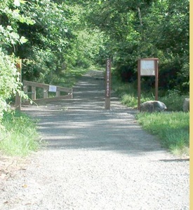
0.00 Columbia Trail begins on Main Street, Rt 513 in High Bridge NJ. Parking is available at the municipal lot across
from the trail's southern terminus.
0.05 Cross Mill Street. Trail is paved.
0.12 Cross Taylor Street. Trail is paved to here, and beyond is crushed stone. Steps on the right access High Bridge Middle School.
0.19 Pass beneath Thomas Street bridge.
0.42 On the right is the beginning of Taylor Steelworkers Historic Greenway Trail. The main trail is yellow blazed
and leads to Springside Farm. The red blazed spur trail to the left leads to an overlook of Lake Solitude Dam.
0.60 Homes border the trail on the right. A depression on the right of the trail is actually a collapsed iron mine. Soon cross driveway access to the homes. Lake Solitude will be visible below the trail to the right.
0.90 Near the end of Lake Solitude. A cabin is visible below the trail to the right.
1.25 A spur trail leads off to the left down to Cokesbury Road in the Hamlet of Readingsburg. Soon, the trail crosses the redecked Readingsburg Bridge.
1.60 The trail passes beneath a cut utility right of way. There are views into the beginning of Ken Lockwood Gorge to the right of the trail from here. This next section is the most secluded section of the entire trail, passing through the deep gorge with steeps slopes on both sides. There is a seasonal waterfall along the trail in this section.
2.50 The teal diamond blazed Highlands Trail joins the Columbia Trail from the left, descending from Voorhees State Park and Ken Lockwood Gorge Wildlife Management Area. Enter a cut.
2.70 Reach Gorge Trestle and cross the South Branch of the Raritan River. This high bridge is one of the jewels of the Columbia Trail. There is an interpretive sign with information here.
3.40 A field appears on the right, as the trail begins to come out of Ken Lockwood Gorge.
3.65 Hoffmans Crossing Road. Cross with caution. An historic through style truss bridge crosses the South Branch down hill from this spot. Bamboo lines right side of the trail.
4.08 Cross a driveway
4.32 Cross a driveway
4.75 Cross a driveway, after passing the former site of John Palmer's junk yard. John Palmer was a World War II Veteran who settled in Califon, and made his living hauling scrap. The grandson of former slaves, he lived into his nineties and experienced many changes in American culture, and was happy to share his memories with everyone he met. He was well known and loved throughout Lebanon Township.
4.80 Begin to parallel Railroad Avenue on the right.
5.15 Pass the historic Califon Railroad Station. One of the first of the stone rail stations, this one was built as a result of a deal between towns people and the CNJ. If the town supplied the stone, the railroad would construct the station. Califon was once called "California", but local lore has it that the man painting the sign did not have enough room to write the name, so he took it upon himself to abbreviate it. The old station is now a museum open first and third Sundays of each month from 1 to 3 pm. Cross Academy Street. The trail parallels Railroad Ave closely.
5.25 Cross Main Street. The trail soon crosses a small bridge over a creek and continues past Califon Lumber. Bank Street parallels, and comes very close to the rail bed as it changes names to Vernoy Road.
5.90 Vernoy Road turns away from the rail bed. Watch for large boulders on the left of the trail, blocking what appears to be an old road. This was the right of way of the former spur line that led to a rock quarry, from which the stone needed to construct Califon Station was taken.
6.20 Cross a driveway
6.35 Reach and cross Vernoy Road. The trail ahead is grassy and runs very closely parallel with Vernoy Road. Many choose to simply walk the road.
6.57 Cross Vernoy Road yet again. Vernoy Road turns away from the rail bed to the left. To the right there is a parallel driveway and an old stone building, possibly a former spring kitchen.
7.00 After a transition from woods to farmland setting, Columbia Trail reaches Valley Brook Road and leaves Hunterdon County at exactly seven miles. Parking available. The Columbia-Teetertown Connector Trail exits to the right, and follows mostly roads. Columbia Trail continues into Morris County ahead, crossing a small bridge immediately.
7.37 Reach the southern end of Jenkinson Nurseries. For many years, this was an interruption in the trail. It was necessary to turn left and head out to Rt 513 because the trail had been farmed over. In 2010, Morris County Parks completed the section of trail across the farm.
7.50 Reach Rt 513 and the entrance to Jenkinson Nurseries. Cross.
8.15 Cross a driveway. There was once a bridge over this driveway, but it was removed presumably due to low clearance. Abutments and a pier remain.
8.20 Reach a trestle over the South Branch of the Raritan River. Very different than the one in Ken Lockwood Gorge, it offers views of a calm section of river, and nicely manicured yards.
8.31 Cross Mallard Cove Road, a private driveway
8.48 Reach Middle Valley Road. This was once the junction with the former Middle Valley Railroad, which led to a trap rock quarry that is now a part of Teetertown Nature Preserve. Plans were made to make this rail bed a connector trail, but they never came to fruition. The first part of the right of way is now a driveway. Part of Ravine Road is built over the southern terminus of this line in Teetertown.
10.35 After a long and overall very boring section with only one small bridge, reach a driveway. Along the driveway to the right is a large tract of NJ Wildlife Management Area.
11.25 Reach Rt 24/Schooleys Mountain Road in Long Valley where there is parking. Cross.
11.37 After crossing a bridge over a small tributary, reach Fairview Avenue. The ruins of an old stone church, built in 1774, are on the right. The rail bed ahead has often been closed due to construction. Once the location of Welch Farms, it is now a new housing development. The mileage presented here will follow the right of way route, but a detour on Fairview Ave may be necessary.
11.63 Former junction site. The Chester Branch of the Central Railroad of NJ once broke off of the High Bridge Branch at the tree line. Very little is visible from here. Some of the grading still exists, but is grown over. The former trestle over the South Branch has abutments and a pier remaining. Further on, some of the Patriot's Path follows this line.
11.67 The rail bed crosses the Electric Brook on an old I-beam bridge and crosses an industrial site. On the other side of the industrial site, a gas line bridge crosses the South Branch. It is not a trail, although many use it as such.
11.90 The trail resumes on the north end of the industrial site, and crosses a driveway.
11.94 Patriot's Path/Gillette Trail turn away from the Columbia Trail on the right. This section leads to Coleman Hill Road. To the left, the abandoned former Patriot's Path leads through woods out to parking on Fairview Ave. It also crosses over an old rail spur to a quarry.
12.15 Patriot's Path, Highlands Trail, Gillette Trail, and Liberty-Water Gap Trail all join the Columbia Trail here. The Highlands Trail follows Columbia Trail back to mile 2.50 in Ken Lockwood Gorge. Gillette Trail section continues only a short distance south, and Patriot's Path and Liberty-Water Gap Trail are co-aligned for a while heading northeast.
12.90 Pass under a power line.
13.16 Cross a utility right of way in farmland.
13.30 Cross Naughright Road at grade in the village of Four Bridges.
13.90 Cross a driveway.
15.00 The trail ends at Bartley Road, exactly fifteen miles from it's southern terminus in High Bridge.
Ahead, the rail line is still in use north to Kenvil, beyond which a long stretch has been quarried out of existence. Sections of it still exist within Hugh Force Park in Wharton, and a short section is now a trail in Wharton as well.
Parking Map

Hosting courtesy of Firebrand Communications. Website design by SGF Studios
©2012 Metrotrails unless otherwise noted • All rights reserved