Long Distance Trails – Bel Del Rail Trail


NEW YORK/PHILADELPHIA METROPOLITAN AREA
OPEN SPACE RESOURCE LIBRARY

Bel Del Rail Trail
Managed by Delaware and Raritan Canal State Park
Map: http://www.state.nj.us/transportation/commuter/bike/pdf/drcanal.pdf
Map: (Trenton section; rail bed shown as 'greenway'): http://www.dandrcanal.com/pdf/FeederInTrenton07.pdf
This forgotten but heavily used path is obscured by the Delaware and Raritan Canal itself, but the majority of the trails along the Delaware follows more closely this historic railroad bed than it does the canal. In fact, the canal terminated at Bulls Island, while the trail follows only the railroad bed north to Frenchtown. Currently, the northern terminus of the rail trail has no access, being in a field north of Frenchtown. The first access point is at 12th Street, along Plessy Field in Frenchtown. The trail follows the rail bed south past Bulls Island, then through Prallsville and Stockton. Although the D & R Canal towpath becomes accessible in Prallsville, the main trail continues to follow the rail bed more closely to an access just below Rt 202 in Lambertville. Though the main trail turns to the canal here, the former Belvidere and Delaware Railroad can still be followed into town until the towpath trail rejoins on the south side of town.
From here south to just below Hermitage Avenue, Trenton, the canal and rail bed are close together. Below Hermitage Ave, the rail trail turns away from the canal, then rejoins again at Willow Street.
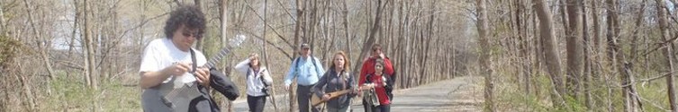
Several loop hikes can be made by using bridges in Lambertville, Washington's Crossing, Trenton, Bulls Island, Stockton, and Frenchtown. Other trails make connections near Cadwallader Park, Trenton, Washington's Crossing, and White Oak Trail at Bulls Island.
Trail: (no blazes)
0.00 The rail trail begins at a point with no access currently, so it requires an out and back hike from the beginning. There are plans to continue the trail north to Milford and possibly beyond. There is a farm access lane where the trail currently begins, just south of Milford NJ.
0.32 Cross a utility right of way.
0.84 The trail comes closer to the Delaware River.
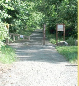
1.25 12th Street Access, the northernmost point of trail access, Frenchtown. Activity fields border the trail on the left.
1.50 8th Street Access, Frenchtown.
1.65 The trail parallels Railroad Avenue.
1.85 Railroad Avenue ends.
1.96 Cross Bridge Street in Frenchtown. The bridge crosses to Uhlerstown PA. Access to the Delaware Canal Trail on the PA side from here is not easy, unfortunately. More convenient loops to the south. Continue parallel to Front Street, and Old River Road south out of town. The old station is now an eatery.
2.40 Cross South Washington Street.
2.65 The trail enters a wide clearing.
2.75 The trail leaves the wide clearing.
2.90 Reach a parking area. Kingwood Boat Launch. The trail closely follows Rt 29, which amazingly has more cyclists on it than the trail.
4.70 The trail continues to run close to the Delaware and parallel with Rt 29. Pinkertons Island appears in the river.
5.15 Continue parallel with the river. Shyhawks Island begins where Pinkerton ends.
6.10 Rush Island in the Delaware River
6.80 Warsaw Road intersects with Rt 29 to the left. Above the road and trail from here is the amazing Devil's Tea Table. Sadly, this outstanding vista is closed to public. Continue south parallel with Walls Island followed by Pralls Island.
9.15 Pass the former site of the Byram-Point Pleasant Bridge. This bridge was washed away in the flood of 1955 and never replaced. The piers still remain in the river.
9.60 Cross River Road. The rail bed turns away from the river a bit. Parallel River Road.
10.00 Stompf Tavern Road intersects with Rt 29 just after the end of parallel River Road on the left.
10.20 Bulls Island begins to the right. This was the northern terminus of the Delaware and Raritan Feeder Canal.
10.90 Cross the access road onto Bulls Island where there is good parking. Short hike possibilities exist on Bulls Island, and a foot bridge placed on the piers of the original vehicular bridge makes possible connections with the Delaware Canal Trail across the river in Lumberville. In addition, White Oak Trail begins just south of the Quarry Road intersection along Rt 29. It connects with the rest of the Lockatong Trail System and other properties.
12.10 Cross the Lockatong Creek on an old bridge. The D&R Feeder Canal is visible below, although the towpath is not easily passable due to many purged areas. It is also no longer a through route.
13.13 Pass a clearing on the right of the trail
13.65 Cross the Wickecheoke Creek on a trestle in Prallsville. From here south, the Feeder Canal is more intact. It does not yet run concurrently with the Bel Del Rail Trail. Wickecheoke Creek Trail follows it's namesake tributary north from here, with minor breaks on it's way to Locktown, the northern terminus. An old concrete shelter is along the right of way to the left.
13.80 A small piece of track is laid to the right of the trail to illustrate it's past function. Continue with houses along the left of the trail.
14.10 Cross Ferry Street in Stockton.
14.20 Cross Bridge Street in Stockton. A lovely railroad mural adorns the side of a building, and the old station has been converted to a deli and convenience store. A loop can be made with the Delaware Canal in PA by crossing the bridge over the river. Continue south on the Bel Del right of way, at first parallel with Railroad Ave.
14.75 South of Stockton, the rail bed crosses the D&R Feeder Canal. They run together more closely to the south.
14.85 An old railroad spur bridge crosses the canal. It was used to access a quarry on the other side of Rt 29.
15.97 A bridge crosses the canal to Rt 29 to the left.
16.15 The trail crosses a utility right of way
16.50 Reach Jimison Farm parking area just after passing beneath Rt 202 and a set of overhead utility lines. Here, the trail splits, and the more used path crosses the canal and follows the towpath south. The Bel Del rail bed continues ahead.
16.65 Cross a bridge over the Alexauken Creek. Nice views including the canal aqueduct.
16.80 Another old railroad bridge over the canal to the left. This was originally the Flemington Branch of the Belvidere and Delaware Railroad, and later the Pennsylvania Railroad. It was used in more recent years for excursion rides for the Black River and Western Railroad, but has long since grown over with heavy weeds. Just past the bridge, an old passenger car sits deteriorating on a piece of rails still in place.
17.20 Parking lot for River Horse Brewery in Lambertville on the right. The tracks still remain here, but are somewhat overgrown.
17.43 Cross Coryell Street
17.55 Cross Bridge Street. The magnificent Lambertville Station is now an upscale restaurant. The tracks continue alongside the restaurant. Loop hikes can be made with Delaware Canal using the bridge.
17.65 After passing a hotel area on the right, cross over a bridge. There is parking for D&R Canal State Park on the right closer to the river. A foot bridge crosses the canal in this area.
17.97 The main trail crosses the canal and rejoins the railroad bed south of Lambertville.
18.20 Pass wing dams in the Delaware to the right. There are nice views of old industries converted into apartments across the river in New Hope.
19.22 Reach Fireman's Eddy, a river access area with a bridge over the canal and parking. There is a nice huge tree just off of the canal to the right. Soon the trail leaves Hunterdon, enters Mercer Co.
20.03 A bridge crosses the canal.
21.05 Cross a stream near where Pleasant Valley Road intersects with Rt 29.
22.60 Cross River Drive, which runs parallel to the trail to the right.
23.25 Cross Church Road in Titusville. Much of the hillside to the left of the trail is the Ted Stiles Preserve at Baldpate Mountain, a Mercer County park.
23.85 Cross Grant Street in Titusville.
24.25 Enter Washington's Crossing State Park. It was here that General George Washington and the Continental Army crossed the Delaware on Christmas Day, 1776.
24.40 Reach the Washington's Crossing Bridge. The bridge can be used to connect hikes with the Delaware Canal in PA. Another trail leads to the left over a pedestrian bridge into the bulk of Washington's Crossing State Park.
25.80 Cross Jacob's Creek on a bridge. A path leads down to the riverside where the lovely stonework of this bridge can be seen more closely.
25.90 Former site of Somerset Junction. Here, the Mercer and Somerset Railroad made it's connection with the Bel Del. It's northern terminus was East Millstone. This short lived line is almost forgotten from history, and few remnants remain of it's history. Jacob's Creek Road is built over part of the right of way.
26.70 Parallel more wing dams in the Delaware.
26.80 Former bridge site over the canal.
26.90 Pass beneath Rt 29 overpass.
27.15 Pass beneath Interstate 95 overpass.
27.55 Cross West Upper Ferry Road.
28.00 Cross Wilburtha Road. Although the trail is nearer to Trenton all the time, it retains a rural and natural character here.
28.72 Cross former Pennsylvania Railroad tracks.
28.87 Cross Lower Ferry Road on a diagonal. Continue with golf course on either side of the rail bed and canal, followed by quiet residential area.
29.83 Cross Sullivan Way on an aqueduct
30.60 Cross Parkside Ave on an aqueduct bridge. To the left is Cadwalader Park, a large, lovely park. To the right is another ball field park. Connections can be made to the ??? park along the Delaware by way of a foot bridge over Rt 29. The trail begins to grow more urban ahead.
31.05 Cross Hermitage Ave
31.30 The railroad bed crosses the feeder canal on a bridge. Here, the trails diverge. The towpath trail turns to the right, while the trail trail continues into a cut.
31.43 The railroad bed passes beneath prospect street.
31.73 Cross Calhoun Street. The East Coast Greenway Trail crosses the Calhoun Street Bridge into Pennsylvania several blocks to the south. The rail bed is sandwiched between Summer and Belvidere Streets ahead as it continues further into Trenton.
31.92 Cross Fowler Street.
31.97 After a short block, the trail reaches North Willow Street. The canal comes into view again ahead.
32.00 Reach the Delaware and Raritan Feeder Canal. Cross the canal. The rail bed and the canal run together from here.
32.10 Cross North Warren Street, followed by North Broad Street. The Trenton Battle Monument is just up the street to the left. This magnificent monument is worth the side trip of only two blocks.
32.25 Cross North Montgomery Street.
32.43 The trail diverges. The Bel Del Railroad ended in this area. The D&R Feeder Canal continues undergrown to the main canal which resurfaces at Mulberry Street to the northeast. The trail to the right, which appears to follow an old spur line, leads to Southard Street near the corner of Oxford Street in about a quarter mile. Continue across Rt 1 on an old railroad bridge restored for pedestrian use.
32.50 Reach a former junction site. A right turn will lead in a fifteenth of a mile to Perry Street. The D&R Canal Greenway was recently opened following the old rail line here. Part of this may be the original Camden and Amboy Railroad, the first public passenger railroad in America. The original engine that operated on this line, The John Bull, is on display in the Franklin Institute.
Following the trail left along the rail bed will lead to Mulberry Street in 1.2 miles. Turn left on Mulberry Street to regain the Delaware and Raritan Canal and the rest of the greenway.
Northern End Southern End
Hosting courtesy of Firebrand Communications. Website design by SGF Studios
©2012 Metrotrails unless otherwise noted • All rights reserved