Long Distance Trails – Appalachian Trail


NEW YORK/PHILADELPHIA METROPOLITAN AREA
OPEN SPACE RESOURCE LIBRARY

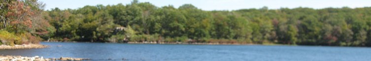
Appalachian Trail (Appalachian National Scenic Trail)
Managed by: Appalachian Trail Conservancy and various organizations, stewards, and volunteers.
The Appalachian Trail, or the AT, has been the subject of an unimaginable amount of books and articles since the first section opened in 1923. The simple thought of attempting a new guide to this trail is foreboding to say the least. Furthermore, the many dedicated organizations who have worked for years to protect, maintain, and promote the trail have created superior guides that are unparalleled in quality, and therefore deserve patronage. We recommend readers to reach out to the following groups for trail information:
Appalachian Trail Conservancy: http://www.appalachiantrail.org/
New York-New Jersey Trail Conference: http://www.nynjtc.org/
Keystone Trails Association: http://www.kta-hike.org/
Here we’ll stray from our trail description, and give you what we feel is the “AT Review” for the sections in our reporting area.
PA 7 Swatara Gap to Clarks Valley (St. Anthony's Wilderness): This is a very nice section for those looking for a deeper woods section, but there are no view points except some seasonal ones of DeHart Reservoir near the western end. The AT leaves Swatara State Park on pleasant and easy routes, then crosses Second Mountain. The biggest points of interest in this section are the long forgotten coal mining towns of Rauch Gap and Yellow Springs. Rauch Gap is the location of the first lime treatment for sulfur seeping into water from coal mines. Yellow Springs Village is now nothing more than piles of rubble, with large trees growing from where the chimneys once stood. The AT follows many woods roads in this section.
PA 6 Rt 183 to Swatara Gap: This section is a bit more interesting compared with the previous ones. The trail passes through some pleasant woods, and makes it's way into Schubert's Gap, the most undeveloped gap on the entire ridge, even more so than in St. Anthony's Wilderness. There is a fantastic view called Shikellamy Overlook. Beyond, the trail reaches another offset ridge known as Round Head, with more nice views that look different than previous ones. Beyond there are a few more viewpoints, and the section out to Swatara Gap is surprisingly pleasant and easy on the feet, lacking some of the sharp rocks that other sections to the north have.
PA 5 Port Clinton to Rt 183: Overall, another rather boring section. The AT leaves Port Clinton, climbs to the Schuykill River Trail, and then up the ridge. There is only one good view point on the AT in the entire section, Auburn Overlook, and even that is meager in comparison with others. The trail does pass through some nice, secluded woods and has a few side trails. There is a slight view from Eagles Nest Shelter, and there is another view called Eagles Nest on a side trail to the south, unrelated to the shelter, which is nice.
PA 4 Rt 309 to Port Clinton: At the beginning of the section, the AT follows mostly ridge top with a few view points. It passes a tri-county corner monument, but the first great view point is from Dan's Pulpit. An offset in the ridge near the Pinnacle is visible from this vantage point. Beyond, the AT crosses through the valley near Eckville, giving it a little more character from the ridge. It then ascends to the Pinnacle. Accessible via a spur trail, this might be the best viewpoint in Pennsylvania. There are also incredible natural caves to explore in these rocks. The AT continues to Pulpit Rock, another great view, then continues on the ridge to Port Clinton, a quaint little town with surprisingly few businesses. One would expect something similar to the village of Delaware Water Gap or Duncannon, but it bears little resemblance.
PA 3 Lehigh Gap to Rt 309: The section between Lehigh Gap and Lehigh Furnace Gap is outright boring, especially compared to it's side trails. The North Trail and the South Trail are even more scenic than the AT on the east side of the gap, with open views from the zinc smelting. Side trails lead off to Lehigh Gap Nature Center as well. The South Trail also bypasses the AT, and while it does not offer views, the rock scrambling and scenery is outstanding. Beyond Lehigh Furnace Gap, the AT misses a fantastic off trail view and forward jutting rock. Bake Oven Knob is the next point of interest. It is a fantastic view. Continuing south, the AT passes the Baer Rocks with more views, and over the knife edge known as "The Cliffs" with more good views.
PA 2 Wind Gap to Lehigh Gap: This section includes what may be the most interesting and scenic spot along the entire AT in PA, however, it is a superfund site. From Wind Gap, there are a few viewpoints, but mostly it is woods. West of Wind Gap, and below the glaciation point, the character of the ridge top changed from being more open with views to being wider and more forested. The views are much farther between, and there are far less side trails. There are a few views between Wind Gap and Little Gap, but from Little Gap to Lehigh Gap there are many. This is due to the zinc smelting that occurred in nearby Palmerton, PA which denuded the entire mountain of trees. In recent years there has been a degree of success planting warm season grasses to mitigate the situation. This section of the AT is like passing through an atomic bomb wasteland. The views however, are outstanding. The slope of the east side of Lehigh Gap is by far the most scenic on the entire PA stretch of the AT. To the north, the town of Palmerton is visible. Many railroad rights of way passing through the area can be clearly seen. Downstream on the Lehigh, one can see the remnants of one of the many Lehigh Canal dams which provided the boats with slack water.
PA 1 Delaware Water Gap to Wind Gap: The beginning of this section is very nice, passing through the village of Delaware Water Gap and ascending Mt. Minsi, with spectacular views (many have said the most scenic view on the AT in Pennsylvania is Mt. Minsi, a view of New Jersey!). The AT continues along the ridge through Totts Gap, and past the Lunch Rocks and Nelson Vista, as well as a few other minor views before reaching Fox Gap. South of here, there are two more views, one unnamed, then the Wolf Rocks, the southernmost point of glaciation on the AT. From here to Wind Gap is by far the most boring section of the AT I have ever hiked. It drags on, and has only one side trail. Even the crossing of Blue Mountain Water Company's gravel road seems exciting to break the monotony! There are some nice seasonal views approaching Wind Gap, but otherwise nothing. This is also the first section heading north to south that has the pointy little rocks that are the scourge to many a hiker in PA.
The trail is impressively nice near Kirkridge Shelter. The side trail to the shelter is better than the AT, because it offers somewhat of a view from the front of the shelter, and is graded very well. Water is usually available at a pump via a side trail courtesy of the Nelson Retreat. Please do not trespass beyond the pump.
NJ 6 Millbrook Blairstown Road to Delaware Water Gap: This section is also quite unique, with plenty of changing scenery. From Millbrook Gap, the AT ascends and passes Catfish Fire Tower, and then follows the nicest section of open cliff in NJ with extensive views. It passes near Appalachian Mountain Club's Mohican Outdoors Center, and over Raccoon Ridge and Mt. Mohican where there are incredible views up the Delaware River and beyond to the Poconos, including the dramatic Wallpack Bend, and toward the Lower Yards Creek Reservoir, and across Warren County. On a clear day, it's possible to see the Catskills from Mt. Mohican. The AT continues through Tocks Swamp, past Sunfish Pond, and then into Dunnfield Hollow. The section from Sunfish Pond to Dunnfield Hollow follows mostly a woods road and is rather boring, but Dunnfield itself is very nice. The AT follows roads and crosses into PA on the Rt 80 bridge. National Geographic's "Mountain Adventure" describes this bridge as the scariest point on the entire AT, because of the width of the walkway and proximity to traffic. I can attest from walking across with an oversized tent on my back that it was rather scary, my equipment hanging over the railing and inches from large trucks blasting by.
NJ 5 Rt 206 to Millbrook-Blairstown Road: A spectacular ridge top hiking experience awaits hikers here. Those who are familiar with the ridge in Pennsylvania would not be so excited at the look of the maps, because there are far less view points there. This section however, has plenty to offer. From the first ascent from Culver's Gap, there are great views of Culver's Lake. Beyond there are views of Lake Owassa through the trees. Occasional views to the north reveal the Poconos, and following Brink Road there are more from Blue Mountain, Bird Mountain, and Rattlesnake Hill. The trail also follows some very nice sections of woods roads that break up the monotony of the foot paths, and make for a relaxing walk. More views abound near Fairview Lake, and yet again before reaching Millbrook-Blairstown Road. There are also nice swamp lands and a beaver pond. This section has many side trails as well.
NJ 4 Rt 23 to Rt 206: This section atop the Kittatinny Ridge through High Point State Park and Stokes State Forest offer some spectacular view points. First, a view over Sawmill Lake is quite nice, and more intimate than many ridge top views because it's closer. Next, Dutch Shoe Rock offers a view of Lake Rutherford, and is an interesting outcropping, sweeping rather than vertical. Further on, Sunrise Mountain is always very nice, despite the fact that it can be driven to. A CCC shelter built in the 1930s, and a USGS marker sit atop this peak with fantastic views of the countryside. Finally, Normanook Fire Tower is at the southern end, and the area around it offers views of Stony Lake and the rest of Stokes. This section has many side trails as well.
Rather than reiterate the guides, we offer information and opinionated reviews of the sections as they are offered in official publications.
NJ 3 Rt 284 to Rt 23: This section ascends the Kittatinny Ridge and continues south. Despite the fame High Point recieves, the most interesting points on the AT in this section are not within High Point State Park, but rather in the valley. The Pochuck Quagmire recieves all fo the attention for it's massive puncheon, but nearly as interesting is the Vernie Swamp puncheon, which meanders intimately through a bog in a twisting fashion. The valley doesn't offer spectacular views, but some vantage points like Wolf Pit Hill offer great views of the High Point Monument, and break the monotony of the ridge top views that begin to look the same after seeing so many. In this section of High Point State Park, the most interesting point is the hawk watch platform just south of the monument. The AT does not reach the High Point Monument itself.
NJ 2 Rt 94 to Rt 284: While there is only really one good view point, this is actually a very interesting section to hike. The trail never seems monotonous, as it passes by constantly changing scenery. It is also more pastoral than the rest of the AT in NJ, often making it's way through cultivated fields, and sometimes between cows! This section has more puncheons than anywhere else in NJ. Two swamp areas in particular stand out. The Pochuck Quagmire, with it's extravagant wooden walkway and suspension bridge over the Pochuck Creek is one of the most famous places on the AT due to it's engineering.There is a good view from atop Pochuck Mountain.
NJ 1 State Line to Rt 94: Compared to many other sections, this one is quite boring. Heading south from the state line, there are fewer views. The trail passes through some nice wetlands, but there is quite a lot of ATV damage, perhaps the worst in the state. It continues into Wawayanda State Park, but has very view views. In fact, there are only two view points in the entire section. The first is from near Barret Road, were to the north hikers can see Mt. Adam and Mt. Eve. The second is the spectacular Pinwheel Vista, via a blue blazed side trail to the north, which offers great views of the Vernon Valley, as well as down the edge of Wawayanda Mountain.
NY 13, Rt 17a to NY/NJ line: This section, all atop the Bellvale Ridge, is not terribly difficult and offers some fantastic scenery, including one spot where a wooden step ladder is placed against the rocks to assist in a hand hold climb. The best views are from State Line Lookout and Grand View, with Greenwood Lake and an obvious island in plain view.
NY 12 Rt 17 to Rt 17a: While not regarded as such an interesting section, maybe because it passes through several different properties, this section has a lot of character. From the north at Agony Grind (not as tough as other trail sections, but still substantial), there are views and many little challenging climbs. Sections like Little Dam Lake, areas with little puncheons, and Fitzgerald Falls all make this section worthwhile. Some place names like Mombasha High Point are disappointing due to lack of view, but still nice. The trail also follows the Bellvale Ridge in this section, and is in part co-aligned with the Highlands Trail. This part of Bellvale Ridge has some great spots including Cat Rocks, the Eastern Pinnacles, and the hawk watch on Peters Mountain.
NY 11 Arden Mountain Road to Rt 17: This section through Harriman State Park was very pleasant, but overall not as interesting as areas surrounding it. It crosses several flat bedrock areas, and there is one serious climb when traveling south to north after Elk Pen parking area. There is also a spot with an abandoned iron mind filled with water. By far, the best part of this section is the giant rocks of the Lemon Squeezer.
NY 10 Bear Mt. Bridge to Arden Mountain Road: This was a fantastic section of the AT. The views of Bear Mountain Bridge and from Bear Mountain itself are of course spectacular, but views from West Mountain and Black Mountain are just fantastic. Closer to Tiorati Circle, it's a bit more boring, with more gently rolling hills and less views.
Hosting courtesy of Firebrand Communications. Website design by SGF Studios
©2012 Metrotrails unless otherwise noted • All rights reserved